ABINGDON HQ (FRIDAY, SATURDAY, SUNDAY)
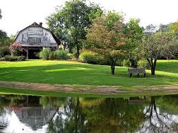
Your vacation will be based for three days at a lovely spot just outside Abindgon. The Southwest Virginia 4-H Educational Center is located on 75 acres of rolling meadows and woodlands 1.5 miles north of historic Abingdon. The site opened its doors in 1960 as a 4-H Camp. The facility boasts a Junior Olympic Size Swimming Pool, Ropes Course and Fishing Pond. All in the pristine Highlands of Virginia and just 3 miles from downtown Abingdon. Watch this great drone aerial video of the facility.
[bt_video src=”http://youtu.be/sECE0JHA8og” preload=”none”]
ABINGDON — PINK ROUTE (FRIDAY)
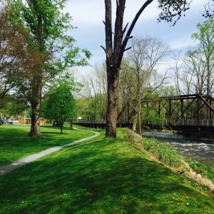
In Abingdon, history is not confined to select sites and preserved buildings. It’s all around. When you look at the mountains surrounding town, you think of Daniel Boone walking through the woods or early American pioneers traveling the Great Road across the Blue Ridge Mountains to settle the new frontier.
When you stroll down Main Street, you think about the Civil War soldiers involved in nearby battles who were treated by nurses on the grounds of what is now the elegant Martha Washington Hotel.
Visit the Abingdon Muster Grounds and you’ll be able to imagine citizen militia members gathering to go off to fight the British for American independence
DAMASCUS, VA — PINK + ORANGE ROUTE (SATURDAY)
Today, the spirit of trailblazing and the sense of community responsibility continue in the town of Damascus. Known both as Trail Town, USA and the friendliest town on the Appalachian Trail this little community is a hot spot of outdoor recreation. The Appalachian National Scenic Trail, the Virginia Creeper National Recreation Trail, the Transcontinental Bicycle Trail, the Iron Mountain Trail, and the Daniel Boone Trail all intersect in Damascus. While the town does have other diverse interests, the natural world and the legacy of trail blazing still influence the course of the future. 
SHADY VALLEY — BLUE + ORANGE ROUTE (SATURDAY)
“The bowl that constitutes Shady Valley, created by the Holston, Iron and Cross Mountains, once flourished with wild cranberries, red spruce and other flora and fauna normally found only in Canadian-like climates. Many of those species are now gone, but some cranberries remain and the valley continues to be know for its uniqueness and beauty.
In a region of so many beautiful places, Shady Valley Tennessee is a real stand out. The famous curving roads which lead up from Mountain City Tennessee to Shady Valley open up to a breathtaking view of a flat mountain valley with corn fields and pumpkin patches and, amazingly, 3 stores and restaurants at the same intersection. Not bad for an area with just over 1,100 residents (2000 census.)
It is believed that the Valley was formed by ice flows during the ice age which also left 10,000 acres of swamp fields,perfect for growing cranberries. However, in the 1960s, the US Corps of Engineers built a drainage system around Beaver Dam Creek to turn the wetlands into farm land. There is only a one-third acre bog remaining.
The history of the cranberry bogs is celebrated each year during the second weekend of October at the Cranberry Festival which attracts around 5,000 locals and visitors.
SALTVILLE — PINK + ORANGE ROUTE (SUNDAY)
Civil War Battlefield Overlook
From the Overlook you can view the terrain on which over 7,000 soldiers engaged in combat on Sunday, October 2, 1864. Interpretive markers related the activities that took place the following Monday morning. Walk in the original trenches where soldiers fought and died.
Palmer Grist Mill
See the beauty of a replica water powered Grist Mill plus the environmental features associated with the unusual surrounding habitat. The Mill houses a community theatre and the working mechanisms from the oldest Plantation style mill in Washington County, Virginia.
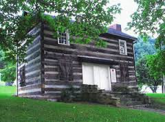
King-Stuart Cabin
The cabin was occupied from its beginning (circa 1795) through the 1960s. See the many visible indicators of the numerous transitional modernization periods the cabin has experienced. 
Salt Park
Located on the Smyth-Washington County line, the park is on the site of early Saltville. See a replica of a salt furnace where the 100 gallon capacity salt kettles are authentic. See an original Walking Beam Pump used as one of the various modes of extraction of brine from salt wells.
Madam Russell Church and Cabin
Visit the church which was named as a memorial to Madam Russell, Patrick Henrys’ sister. Walk through the original portion of the church and see the many beautiful features, including the magnificent stain glass windows. Tour the replica cabin of Madam Russell and enjoy the stories of her tremendous influence throughout the years.
For more interesting locations to visit in and around Saltville, visit the Saltville Website.
HUNGRY MOTHER STATE PARK, VA — ORANGE ROUTE (SUNDAY)
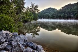
Long a family favorite known for beautiful woodlands and a placid 108-acre lake in the heart of the mountains, Hungry Mother has a sandy beach with bathhouse, boats (fishing, canoe, kayak and paddle) and a boat launch, and a fishing pier. 
The Legend of Hungry Mother
Legend has it that when the Native Americans destroyed several settlements on the New River south of the park, Molly Marley and her small child were among the survivors taken to the raiders’ base north of the park. They eventually escaped, wandering through the wilderness eating berries. Molly finally collapsed, and her child wandered down a creek until the child found help. The only words the child could utter were “Hungry Mother.” The search party arrived at the foot of the mountain where Molly collapsed to find the child’s mother dead. Today that mountain is Molly’s Knob, and the stream is Hungry Mother Creek.
KINGSPORT HQ (MONDAY,TUESDAY,WEDNESDAY)
The City of Kingsport received its name from a simplification of the name “King’s Port” which was the old name given to the area along the Holston River by early pioneers. The Long Island of the Holston River in Kingsport has a vast and rich history and is a U.S. National Historic Landmark. It was the home of the sacred council of local Cherokee and was a meeting place for treaties and other dealings with other Native American tribes, early pioneers, and settlers. Also, the name of the State of Tennessee comes from the old Yuchi Indian word “Tana-see”, which means “The Meeting Place”. In 1775, Daniel Boone began the Wilderness Road from the Long Island of the Holston when he began his expedition through the now famous Cumberland Gap. In 1822, the Holston River was first chartered by boat. Early pioneers and settlers used the river to transport products and people to Knoxville, where the Holston meets up with the Tennessee River. From there pioneers quickly discovered that the conjoining river systems could lead to the Ohio River and eventually to the Mississippi River and Gulf of New Orleans. The development of the use of the Holston River for transportation and commerce brought many jobs and settlers to the area.
CAMPGROUND/HEADQUARTERS — ALLANDALE MANSION
Intriguing history and southern elegance create the romantic setting of Kingsport’s Allandale Mansion, often called Kingsport’s “White House.” Built in 1950 by Ruth and Harvey Brooks, Allandale still houses their fine furnishings, antiques and art. Allandale Mansion was willed to the City of Kingsport in 1969. It is a classic example of Georgian architecture with four chimneys, a hipped roof and formal fireplaces in the main rooms. In true Georgia style, a grand curved wooden staircase dominates the mansion’s foyer. The grounds are expansive and shady. You’re sure to love camping at this site. Read more about Allandale Mansion on our history Around Allandale blog post.
But don’t just take our word for it… seeing is believing! Check out this video of Allandale Mansion and grounds:
[bt_video src=”https://youtu.be/lPcnaNKgpew” preload=”none”]


